|
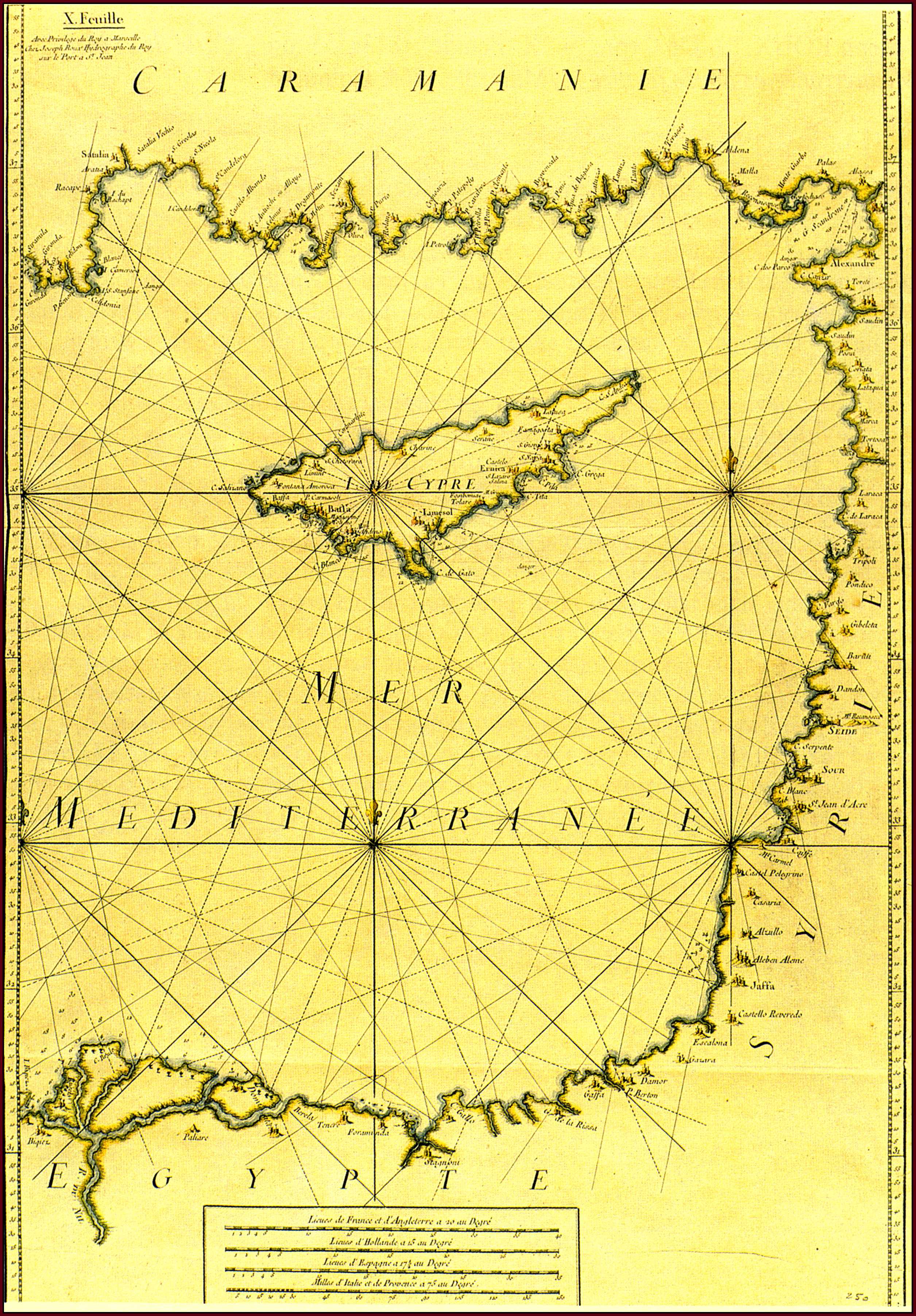
Joseph ROUX , "I. De Cypre" - "X. Feuille" (813x555mm) , Carte de la Mer Mediterranee en douze feuilles..., Marseille 1764 . Coloured . |
|
This sea-chart is the tenth of twelve maps in J. Roux's Carte de la Mer Mediterranee from which he extracted and published in the same year(Marseille 1764) his Recueil of the main ports around the Mediterranean (Fig. 68) . The chart shows not only Cyprus , but also the coastlines around the Eastern Mediterranean . The map of Cyprus does not follow any of the established cartographical renderings of the island . This indicates how completely different the line of development was as far as sea-charts were concerned , since they were made by sailors for navigation purposes . For the same reason , most of the contents are on the south coast where navigation was more frequent and the place names are heavily corrupted since they are written the way they were pronounced by sea-men . After ca 1779 another plate was made for this map , but the present copy is from the original plate . |
|
![]()
|
|
|