|
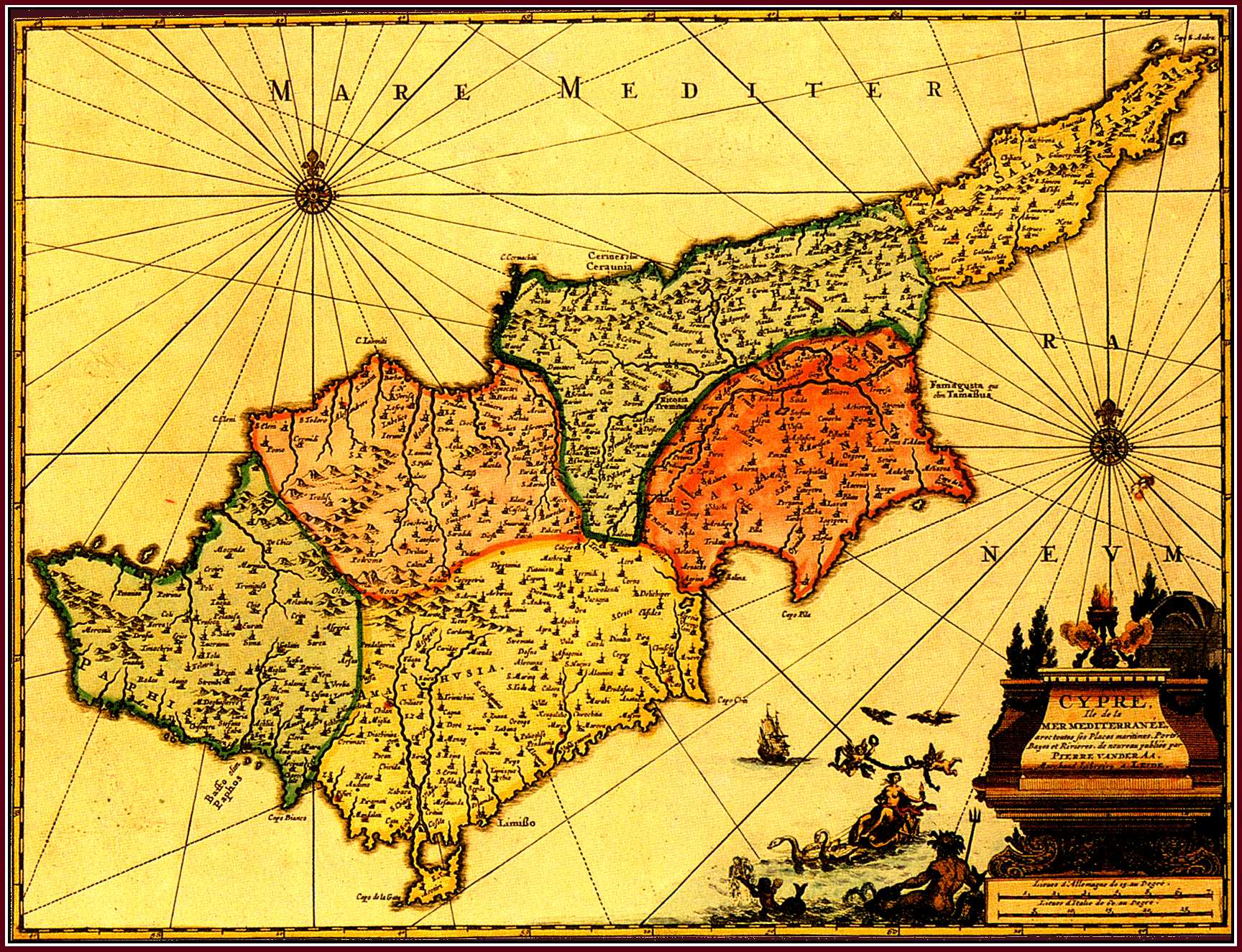
Pierre (Pieter) van der AA . "Cypre Ile de la Mer Mediterranee ..." (286x376mm) , Nouvel Atlas , Leiden 1714 or 1730 . Coloured . |
|
This map by van der Aa copies the Cyprus map of Blaeu (Fig. 37) . It is smaller in size and Blaeu's exquisite decorative treatment has been replaced by a cartouche and new pictorial motifs . The map was first published by van der Aa in his Nouvel Atlas (1714) which ca 1730 was re-issued in Amsterdam . Finally , ca 1729/30 the map was included in the very rare multi-volume atlas of van der Aa , La Galerie Agreable du Monde (Leiden) . |
|
![]()
|
|
|